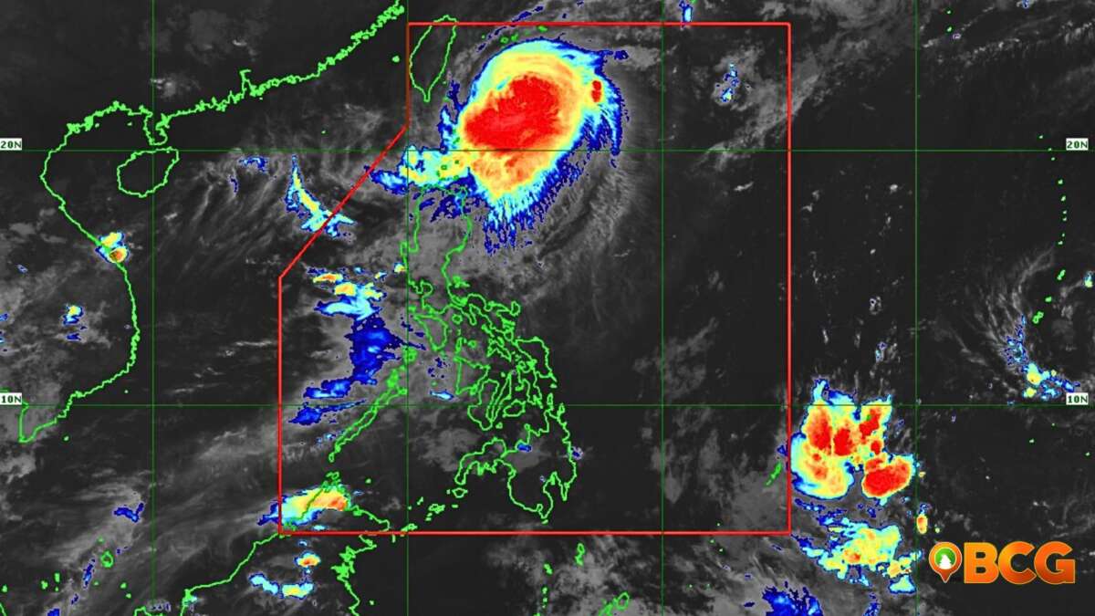
LPA East of Isabela Developed Into Tropical Depression Julian
At 8:00 AM today, August 28, 2020, the Low-Pressure Area East of Isabela has developed into Tropical Depression “Julian” according to Philippine Atmospheric, Geophysical and Astronomical Services Administration (PAGASA).
Location of Eye
In the PAGASA’s report, the location of the center of TD Julian as of 10:00 AM today was estimated at 940 km East of Casiguran, Aurora or 975 km East of Tuguegarao City, Cagayan (17.1 °N, 130.9 °E ).
Strength and Movement of Julian
Julian has maximum winds of 55 km/h near the center and gustiness of up to 70 km/h, and it is moving westward at 15 km/h.
Forecast Track of Julian
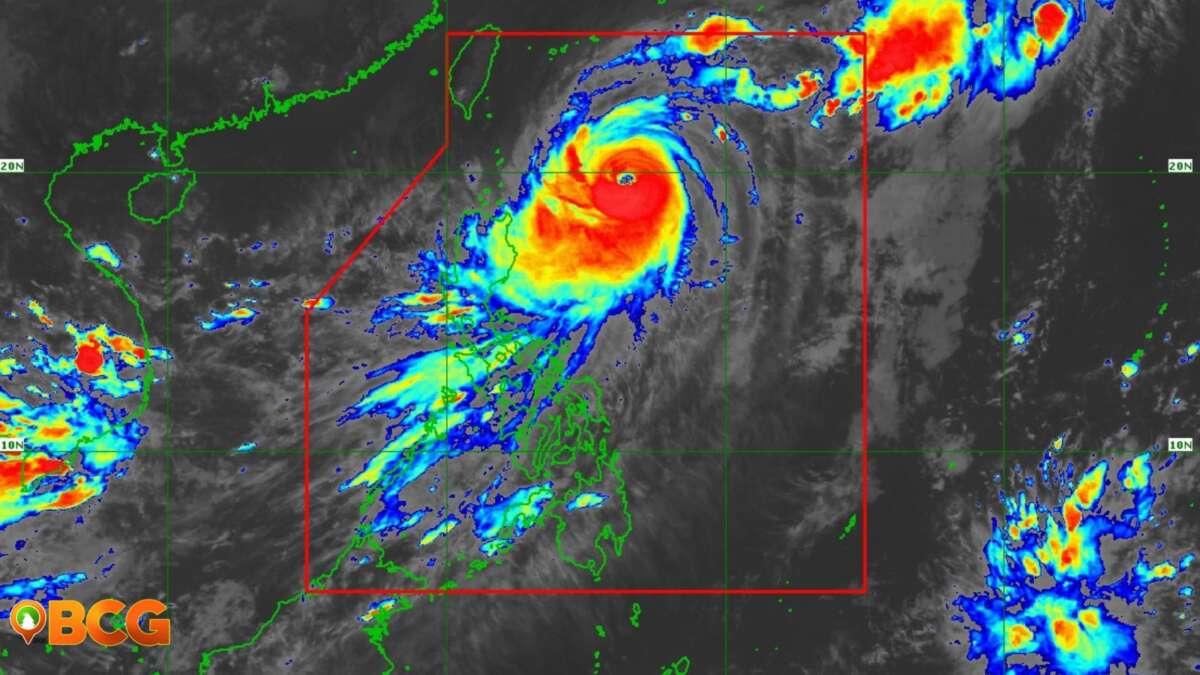
In the latest update of PAGASA, released 11:00 AM today, TD Julian is forecast to move westward to west-northwestward today through tomorrow, August 29, 2020, morning, then turn northward tomorrow evening.
According to the forecast track of PAGASA, TD Julian will remain over the Philippine Sea throughout the forecast period, far from the landmass and it is likely to intensify throughout the forecast period
Furthermore, TD Julian will likely exit the Philippine Area of Responsibility (PAR) on the evening of August 31, 2020.
Here are the following forecast positions of TD Julian:
- August 29, 2020 morning (24 Hour): 885 km East of Tuguegarao City, Cagayan (16.8°N, 130.0°E)
- August 30, 2020 morning (48 Hour ): 860 km East of Aparri, Cagayan (18.5°N, 129.8°E)
- August 31, 2020 morning (72 Hour): 730 km East Northeast of Basco, Batanes (22.9°N, 128.5°E)
- September 1, 2020 morning (96 Hour): 805 km North Northeast of Extreme Northern Luzon (Outside PAR) (27.1°N, 125.1°E)
- September 1, 2020 morning (120 Hour): 1,130 km North of Extreme Northern Luzon (Outside PAR) (30.4°N, 124.2°E)
It is expected that TD Julian will reach tropical storm category within 12 hours and severe tropical storm category within 24 to 36 hours. On August 30, 2020, TD Julian is forecast to reach the typhoon category.
In addition, the raising of tropical cyclone wind signals of TD Julian is unlikely and it is less likely to directly cause high impact weather over the country.
Source: PAGASA, Dost pagasa Facebook Page